Over the past week, numerous communities across the United States have been devastated by tornadoes, with over 60 fatalities, hundreds of injuries, and countless homes and businesses destroyed. As tornado season continues, another outbreak looms in the near future, and experts are warning that this one could be particularly dangerous. This article will explore the factors contributing to this outbreak, discuss potential impacts, and provide resources for those seeking to stay informed and prepared.

A Sinister Storm System
A significant factor in the coming tornado outbreak is a large trough of cold air that will settle into the western US on Monday, causing heavier snow showers in the Cascades and down towards the Rockies. This blast of cold air will clash with warm air coming up from the south, eventually meeting and creating the conditions for a full-blown storm system to develop near Denver, Colorado late on Monday. This system will bring gusty winds and heavy snow to Utah, Idaho, Wyoming, and western Colorado.
Severe Weather Outbreak
The combination of the huge pocket of cold air aloft, warm moist air being drawn from the Gulf of Mexico, and the deepening low-pressure system to the north sets the stage for a severe weather outbreak. This event has similarities to past destructive outbreaks, such as the April 26, 1994 Outbreak and the 2012 Leap Day outbreak, both of which led to significant damage and loss of life. However, there are also many differences, and smaller, localized features that will only become clear as the event unfolds.
High Confidence in Significant Impact
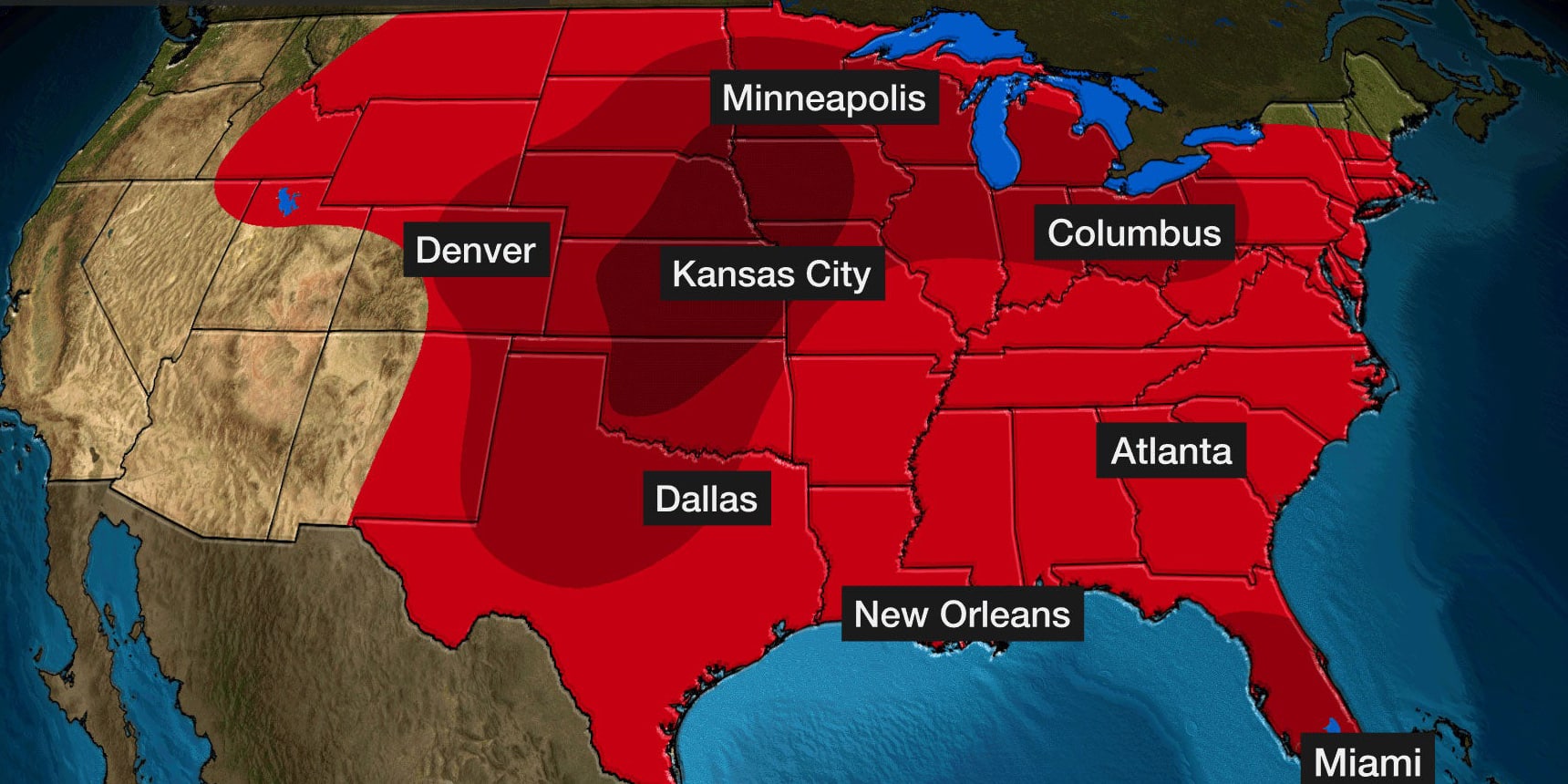
One reason this outbreak is concerning is the Colorado State University Machine Learning Probability model, which has proven to be accurate and is currently maxed out for a large area on Tuesday. This indicates high confidence in a significant event. The wide warm sector of the storm suggests that every storm that forms has the potential to become a long-track supercell, capable of producing tornadoes.
Timing and Threats
While exact timing remains uncertain, storms are expected to start popping off during the afternoon on Tuesday from Texas to Wisconsin, potentially developing into an outbreak of supercells producing large hail and tornadoes. These storms will progress eastward until around midnight, when a massive squall line with destructive winds will form in eastern Nebraska and march eastward.
Resources and Preparedness
As the severe weather threat continues into Wednesday and beyond, it is crucial to stay informed and prepared. With the potential for destructive tornadoes, heavy rain, and flash flooding, residents in affected areas should closely monitor the situation and take necessary precautions to protect themselves and their property. As we move deeper into April, the active severe weather pattern is expected to persist, making preparedness and awareness all the more essential.

