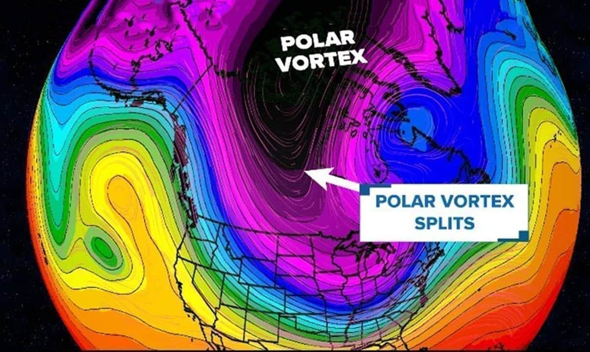
We all hoped for a nice and warm Valentine’s Day, but it doesn’t seem like we will be experiencing that at all. This Valentine’s Day will likely end up quite cold overall, for a very specific reason.
According to CNN, a polar vortex is ‘setting the stage for a crippling ice storm’ or something along those lines. This meaning some states could be facing heavy snow and things of that sort. This cold air is coming from the Arctic and is really punishing the US or at least will be very soon. I know, that might put a damper on the holiday we’re facing this weekend, but perhaps we can all still make the most of it.
CBS News wrote as follows on the topic:
The polar vortex has become synonymous with winter’s most brutal cold. For days, the weather system has been sitting and spinning right along the U.S.-Canada border, with temperatures as low as 43 degrees below zero in northern Minnesota.
But now, there are signs it is about to surge south, bringing with it record-shattering cold air from the far reaches of Alaska and Northern Canada. By the weekend, temperatures in Kansas City and St. Louis will be below what’s normal for Fairbanks, Alaska.
Ahead of this Arctic blast, there will be a series of winter storms along the collision zone of cold and warm air, bringing ice from Texas to Tennessee and significant snow to Washington, D.C.
The polar vortex is a sprawling area of cold upper-level low pressure that typically resides in the Arctic. But every so often, the normal winter pattern becomes disrupted, splitting the polar vortex and sending pieces flying in different directions. One of those pieces is sitting just north of the U.S.-Canada border.
This bitter airmass landed there because of a phenomenon called a sudden stratospheric warming, a natural event that occurs 50,000 to 100,000 feet above the Arctic every couple of years, throwing weather patterns off-kilter. This event is often followed by a mountain of unusually warm air near the Arctic circle that acts to reroute pieces of the cold polar vortex southward.
This type of pattern creates extremes all over the world. For the past couple of weeks, instead of a gradual temperature gradient around the Northern Hemisphere, there have been pockets of extreme cold intermixed with record warmth.
As a result, temperatures on Tuesday dropped to 43 degrees below zero Fahrenheit in Cotton, Minnesota, which was 133 degrees colder than the hottest temperature in the U.S. — 90 degrees — in south Florida.
In a bout of weather whiplash, the bitter cold comes on the heels of one of the top 10 warmest Januarys on record in the U.S., with the highest departures from normal right where the coldest air is now.
This situation as a whole is creating quite the ice storm as we move through the next few days that in itself should continue as it has been. Depending on what state you’re in, things might really be getting lower and lower as time passes.

